Katerina embarks on an epic Vancouver Island hike from Bamfield, BC along the Cape Beale Lighthouse Trail – a hike that turns into a true adventure story with sandy beaches, dense forests, encounters with bears, and a guided tour by the lighthouse keeper. At times dangerous, at times magical, the route tests not only physical endurance but also the strength of relationships.
Cape Beale Lighthouse Trail
Lighthouse Keeper, Bears, and the Romance of Sandy Beaches
As wildfires rage near Bamfield, BC in August 2025, it’s worth pausing to remember just how breathtaking this area can be. Most of these fires are caused by humans, yet the landscape itself remains a reminder of how awe inspiring Vancouver Island‘s nature is. This is the story of a magical day hike we took along the Cape Beale Lighthouse Trail, southwest of Bamfield, on the ancestral lands of the Nuu chah nulth First Nation. It was just a day before the wildfire started near Bamfield.
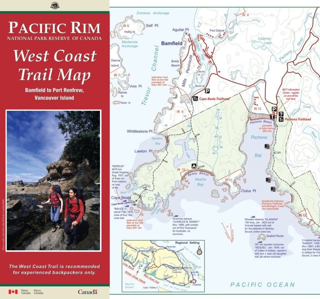
The Cape Beale Lighthouse Trail runs along old telegraph lines that once connected the lighthouse to Bamfield. The hike takes only about four hours, but slippery forest roots, the sandy beach, the lagoon, and the lighthouse walk stretched it out to six hours! And then there were the unexpected surprises! Few people know the Cape Beale Lighthouse Trail — no more than 300 hikers pass through here each year.

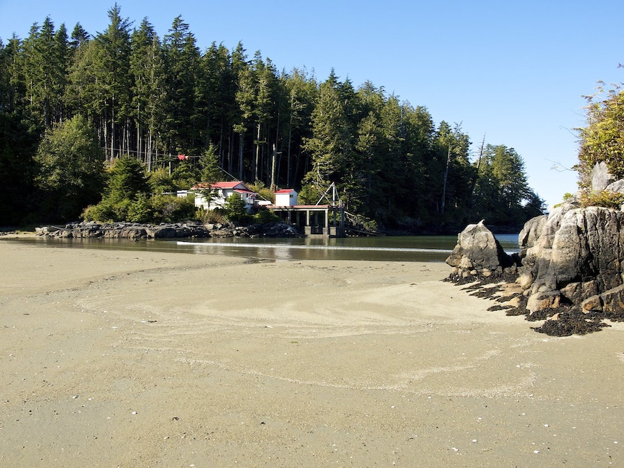
Bamfield Inlet : Romance of the Sandy Beach
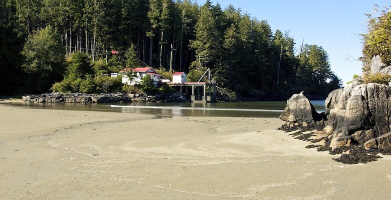
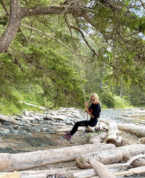
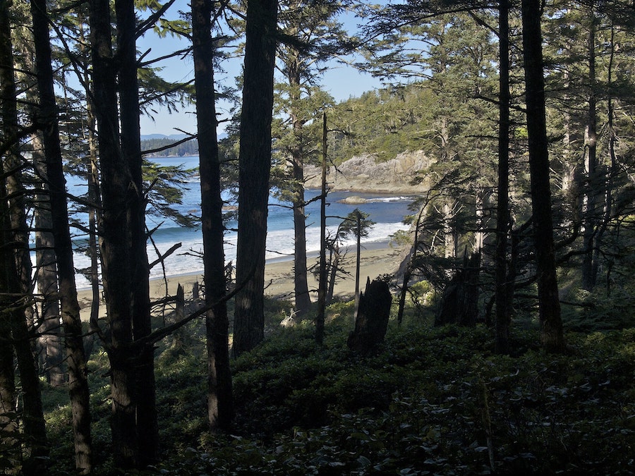
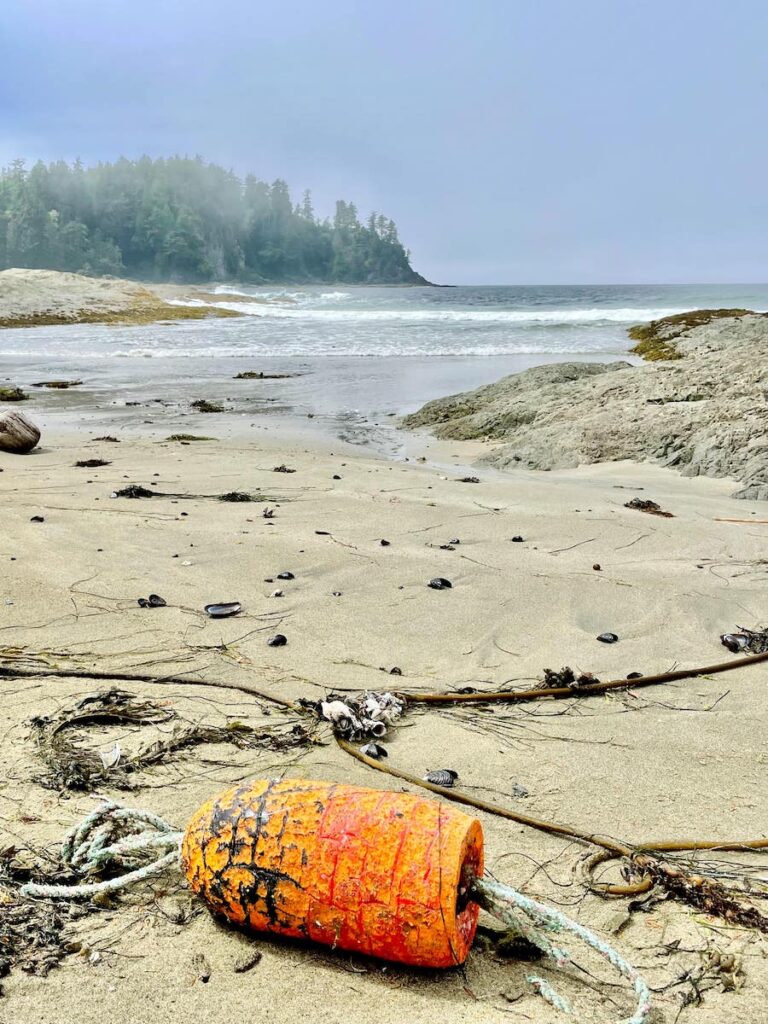
The Cape Beale Lighthouse Trail embarked through the forest, then, pushing through thickets of scratchy blackberry bushes, opened onto a sandy beach near the end of Bamfield Inlet.
The tide was out. Gentle waves rolled softly onto the shore, leaving behind the wet gleam of sand. At the water’s edge were tangles of seaweed, shells, crab clinging to the ribbon-like stems of kelp, and strange artefacts washed ashore by the ocean. Were it not for camping being prohibited, we would have happily got set to stay, there was so much to explore. Although, in the distance, through the mist, we spotted a lone tent.
I couldn’t resist swinging on a rope swing someone had thoughtfully hung from a branch. I ran along the water’s edge. Fog was rolling in, and a fine drizzle settled softly on my hair. The cliffs at the edge of the beach gradually dissolved into a white veil, and we returned to the Cape Beale Lighthouse Trail, diving once again into the cool shade of the forest.
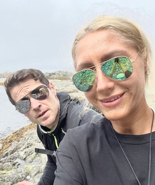
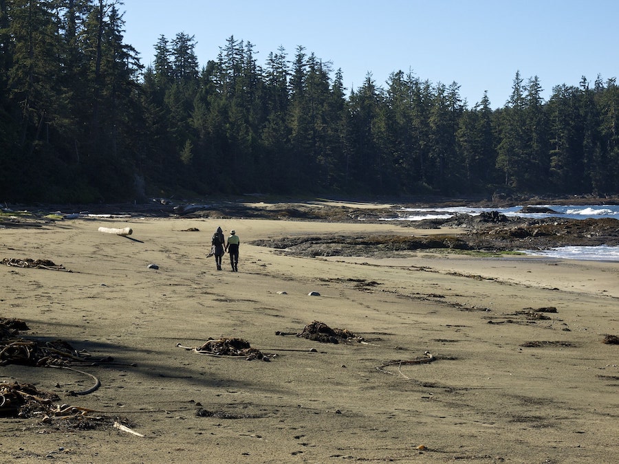
There’s something magical about finding a partner with whom you can share moments like these, someone willing to tackle a challenging trail with you and overcome unexpected obstacles, turning them into part of a romantic adventure.
A Bear Encounter on the Cape Beale Lighthouse Trail
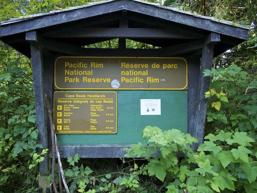
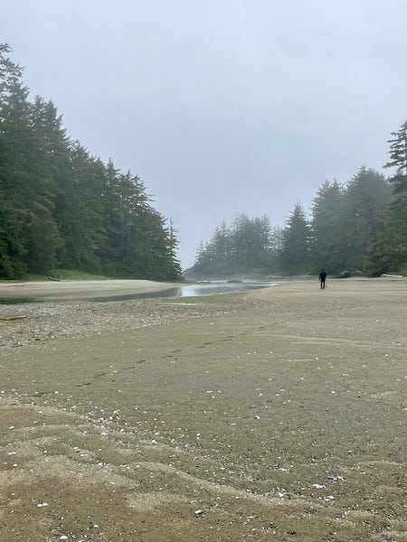
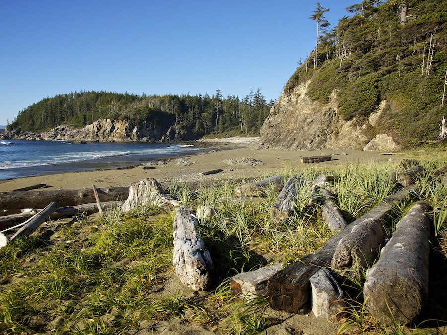
The Cape Beale Lighthouse Trail from here winds through the forest before opening onto a breathtaking sandy beach at Tapaltos Bay. Overnight camping is officially prohibited, though we did spot traces of a couple of tents.
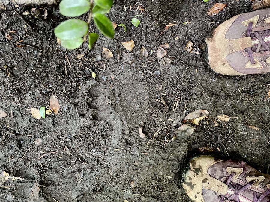
On the shore were wolf tracks, in the forest signs of bears’ activity. Years of wandering Vancouver Island’s forests teach you to read what they’ve eaten—fish or berries. You learn to distinguish coastal wolf tracks from dogs’ and to gauge the size of a bear that passed right before you. Both bears and wolves can be encountered quite easily; the key is knowing how to behave and, above all, trying—desperately trying—not to panic.
Somewhere halfway along the trail, we finally came face to face. I was leading, constantly losing my balance on slippery roots poking out here and there. The trail, with its rotting wooden planks and thorny bushes, left us pretty scratched up. Those bushes would later play their part. At times, pushing through dense greenery felt like walking through a green tunnel leading to Totoro—the gentle forest spirit from the Japanese animated film—revealing, perhaps, the invisible closeness to Japan. In some spots, I had to carefully balance on slick roots to avoid falling.
On a narrow section, our path was suddenly blocked by a muddy puddle—and directly in front of us, a bear with a massive snout. It froze, studying us carefully, assessing the situation, trying to determine if we were a threat. We stayed still, speaking quietly in short phrases. “Should we back away?” “What if it followed us?” “Should we risk moving forward and hope it passes by?”
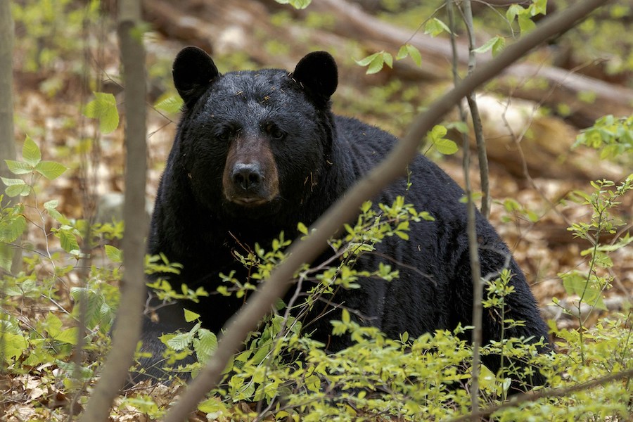
I turned the music on loudly. The bear retreated into the bushes but kept watching—curious and wary, just five meters away. The tension rose, the waiting—wondering who would act first—felt endless! I grabbed a whistle and blew with all my might. The response was immediate—the bear made a sharp, broken hissing sound, frightened, as we later learned. A clear warning: “Do not come closer.” I fell silent, bear spray at the ready. For a couple of minutes we stood, eyes locked on each other. Finally, the bear lost interest, repeated its threatening hiss, circled us through the thick bushes, and walked away on its path.
The trail was clear, but our hearts continued pounding. In the mud, deep, enormous paw prints remained.
Hiking is not just a test of physical strength. It’s a trial, a test of the resilience of a relationship. My partner stepped forward, placing himself between me and the bear. In moments like these, you realise that romance is not just a walk along a sandy beach, but also trust and the feeling of being protected.
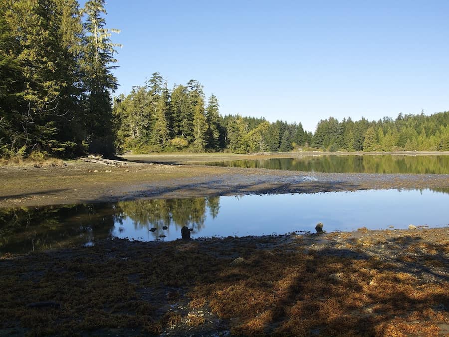
The Lagoon on the Cape Beale Lighthouse Trail
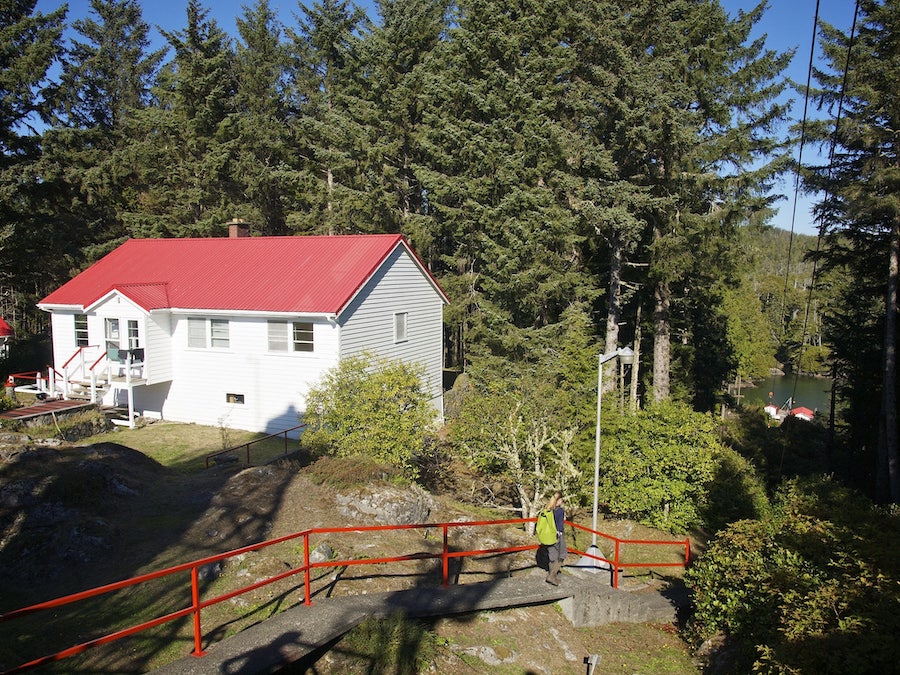
We reached the lagoon behind the Cape Beale Lighthouse, that can only be crossed by hiker at low tide. In the bay stood a charming little cabin … or a machinery shed, as we soon discovered with a chuckle.
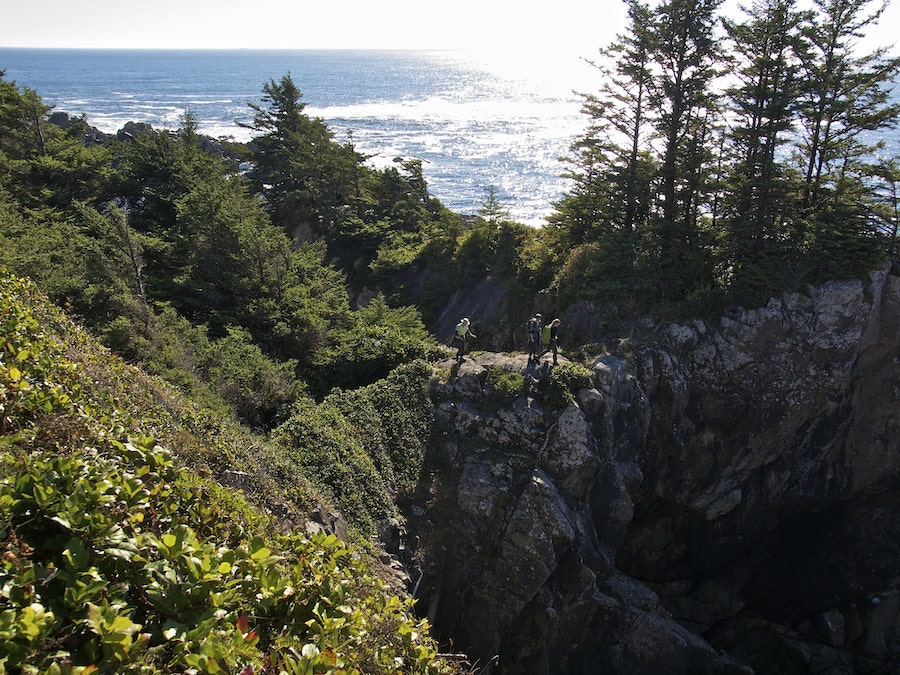
Rounding a rocky outcrop, we stepped onto a trail marked with bright buoys, hanging from tree branches like protective charms. These improvised markers serve as guides: if someone is shipwrecked or lost in the fog, they help lead the way back to safety.
It seems that tales of sea monsters and shipwrecks belong to the past, to the era of Captain Jack Sparrows, when navigation relied on the stars, the weather was unpredictable, and ships smashed against hidden reefs. Today, we have precise maps, satellite instruments, and radar—but the west coast of Vancouver Island still reminds you that nature is stronger than humans, and lighthouses and lighthouse keepers still hold an important role in coming to the aid of those at sea.
High on the headland, my partner spotted a narrow path—was it really a trail? Who could have even made it? The lighthouse keeper? The path runs along the very edge of a cliff, eventually turning into a narrow natural bridge hanging over a churning sea below. This is the natural arch, popular for Instagram photos from Cape Beale.
Cape Beale Lighthouse
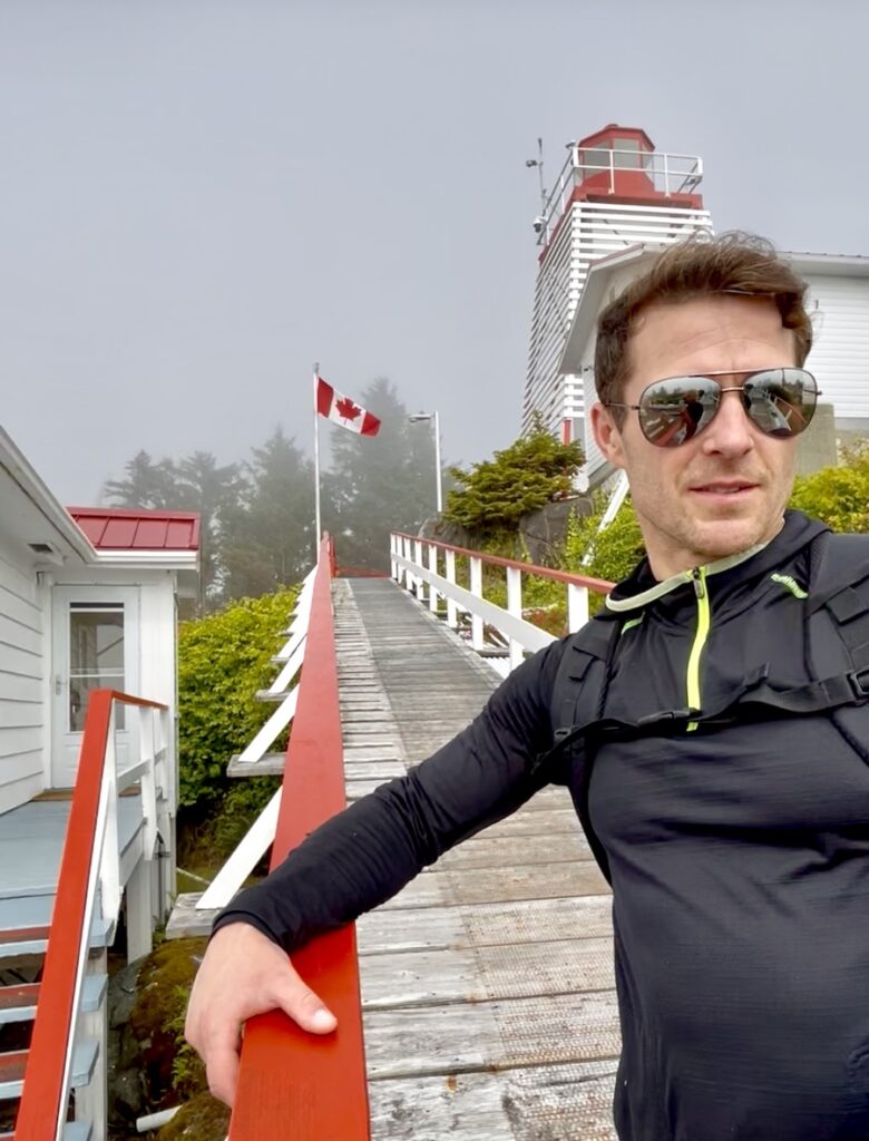
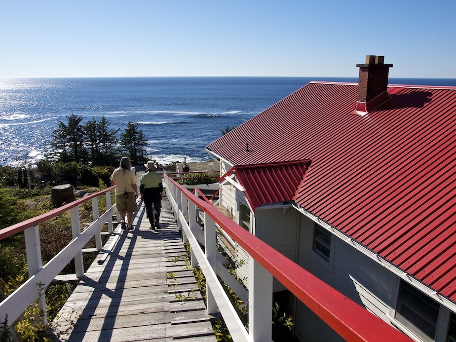
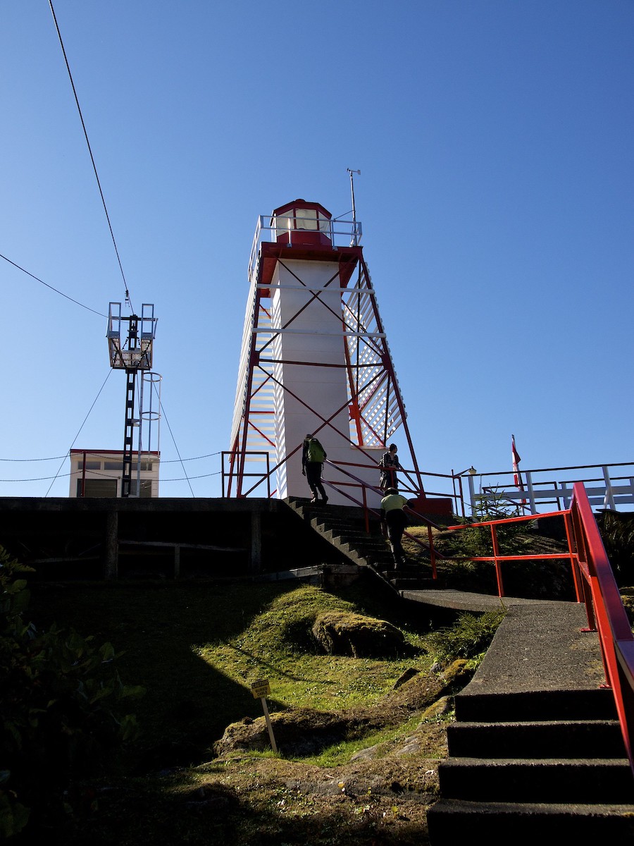
Finally, we reached the Cape Beale Lighthouse — tall and red-and-white for maximum visibility in any weather. On the grounds were the lighthouse keepers’ cottages, a greenhouse full of greenery, a hammock area, and verandas with wetsuits drying on the railings. The whole scene looked like a set from a post-apocalyptic movie—like true life had only survived here. A ginger cat, resembling a tiny cougar, approached us, stretching and curiously peering into our eyes.
A tanned woman emerged from one of the cottages and introduced herself as the lighthouse keeper — Karen Zacharuk.
Stumbling over my words, I began expressing my excitement.
“Excuse me, this is my first time ever talking to a lighthouse keeper … a female lighthouse keeper! For me, this feeling is more thrilling than meeting a favourite actor!”
It was a shame about the fog — usually, the views from here are breathtaking. Sometimes, you can even see Japan, though it lies 7,419 kilometres away. Professional habit makes me think in coordinates and precise distances; I would have rounded that number a long time ago.
“Would you like me to give you a tour? Visitors are rare here.”
Indeed, checking the visitor log, we found very few names recorded over time.
History of Cape Beale Lighthouse
The lighthouse at Cape Beale is the oldest operational staffed lighthouse in British Columbia. For 150 years, its light has guided ships past the treacherous rocks of Vancouver Island’s west coast. Before the first beam was lit here in 1874, these shores were a nightmare for sailors.
Cape Beale stands like a living museum—its light still cuts through the fogs, that in the 19th century claimed ships, while its keepers continue traditions that may soon exist only in history books. The galvanised steel tower, clad in asbestos panels, is surrounded by a steel frame supporting horizontal wooden slats painted white — a daytime navigational marker for mariners.
Cape Beale cannot be called completely remote. It can be reached by boat — if tides and sea conditions allow — or via a challenging 10-kilometre trail from Bamfield, which is the route we took.
By comparison, some lighthouses in British Columbia are accessible only by helicopter, lack cell service, and offer only limited internet access. There, keepers rely on radiotelephones invented decades ago. Many of these stations are located in areas notoriously subjected to torrential rains and hurricane-force winds.
Cape Beale Lighthouse Tour
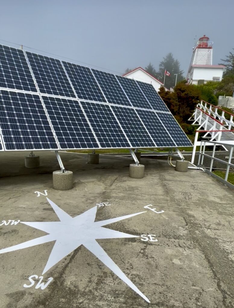
Energy
Due to its remoteness, the Cape Beale Lighthouse generates its own electricity using solar panels and wind turbines, harnessing the constant coastal wind and sunlight. The electricity is stored in batteries, and the system automatically shuts down if more energy is produced than needed. Sometimes emergencies happen: on one occasion, the power went out completely, and Karen had to manually clean the diesel engines, pump fuel, and restart the system.
Weather Office and Local Dark Humour
Karen’s office, with a view of the ocean, is where she prepares weather reports. Shelves hold guestbooks signed since 1999, and the walls display photographs of lighthouse keepers from the late 19th century. Romantic beauty coexists here with solitude.
“Don’t you get bored here?” we asked.
“Not at all! I can no longer live in big cities. There’s always something to do at the lighthouse!”
Nearby is a neat tool shed, with every item hanging in its place.
They have ‘Rescue Randy’ — a crash-test-style mannequin used for practicing rescue techniques. It has its own story. About twenty years ago, it washed ashore in Deadman’s Bay, dressed in a U.S. Coast Guard patrol suit. When the relief keeper first spotted it on the beach, it must have been a shock — it looked exactly like a real body. Later, we learned it was likely used for man-overboard training, but somehow drifted away and was never recovered.
Now it ‘lives’ in one of the spare buildings, scaring newcomers when they stumble upon it.
Supplies and Equipment
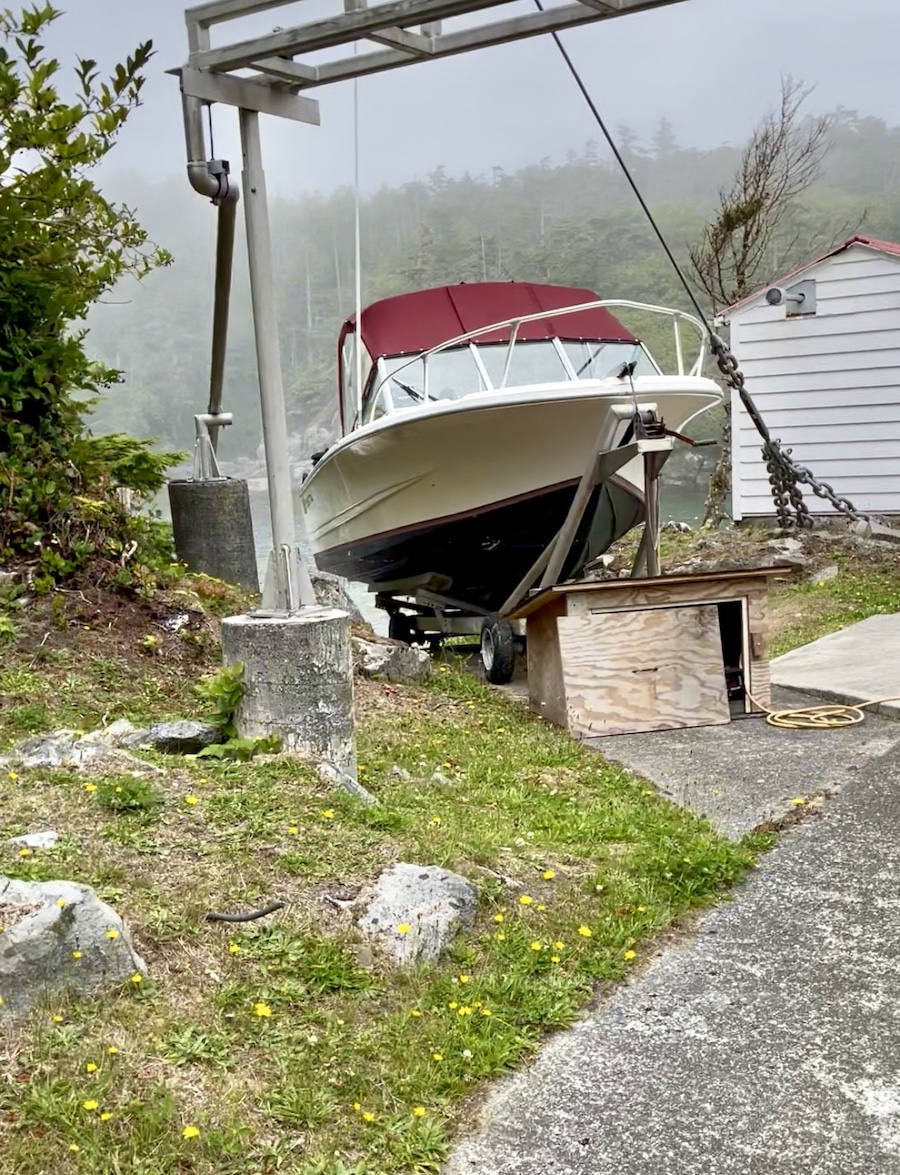
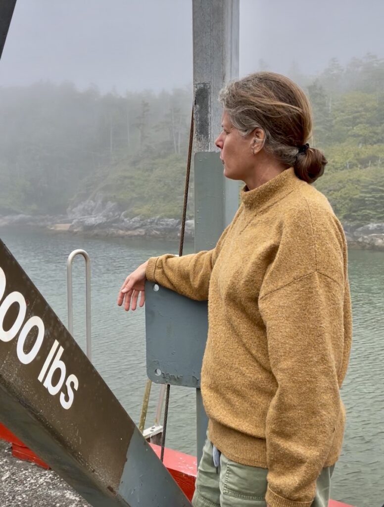
All supplies are delivered by helicopter or boat during high tide and hoisted to the lighthouse using ropes and a winch with a lifting capacity of about 450 kg, powered by a World War II-era diesel engine. Food, fuel, oil, and wood are transported this way. At the dock, bags of garbage and recyclable materials are collected.
Lighthouse Keeper Responsibilities
Karen constantly monitors boats and kayakers near Cape Beale — one of the most dangerous stretches of the British Columbia coast. Just off the shore lies a hidden reef, invisible from the surface, and many vessels have capsized after coming too close. Strong currents, unpredictable waves, and sudden weather changes make navigation here especially hazardous for sailors.
Often, she is the only one who hears distress signals and alerts rescuers, and sometimes she must personally intervene when boats and helicopters cannot reach the scene.
Without cameras, Karen remains constantly vigilant, scanning the sea and shoreline: noticing shifts in fog, sudden waves, or vessels in danger can save lives. Any mayday signal is immediately transmitted via radio, especially near the dangerous reef where fishermen sometimes venture too close.
In 2014, an overturned boat near the reef nearly became a deadly trap: rescuers heard faint cries and managed to help the crew, one of whom was trapped in the bow. Many such incidents have occurred. The boat we saw in the lagoon is the remnant of an old shipwreck, stuck in local waters—a silent reminder of how quickly the ocean can change lives.
The elements are unpredictable! After the 2011 tsunami in Japan, waves brought Japanese debris to the shores of British Columbia with 289 marine invertebrates and two species of fish on them, demonstrating the incredible power of the ocean and the global interconnection of our seas.
Life at Cape Beale Lighthouse
Karen previously lived on a sailboat in Vancouver Harbour, where she and her husband attended school. About 18 years ago, she saw an advertisement for a lighthouse keeper position and decided to take the risk. Moving to her first lighthouse with her husband — who took a job at nearby Coast Guard stations—became a true adventure and a test of their shared spirit.
Life at the lighthouse requires self-sufficiency and ingenuity. Karen grows tomatoes in a greenhouse, collects rainwater in barrels, and even created a water reservoir from an old storage building. She enjoys crafts, swims with a mask in the channels between islands, and observes marine life.
On her favourite motorboat, she goes fishing, rescues lost fishermen and kayakers, and transports her husband to work in nearby Bamfield, where he serves with the Coast Guard. When she isn’t driving him, it takes him two days to reach work: first along the trail we hiked, then by his moored boat to Bamfield.
In her free time, Karen explores coastal beaches, collecting items washed ashore by the ocean — from Japanese glass floats to other unusual finds. Recently, she discovered a ceramic coffee table, which she placed near the hammock — her favourite spot for reading and relaxing with tea in the lighthouse’s solitude.
Heading Back
(Along the Cape Beale Lighthouse Trail to Bamfield … And Hopefully to Cape Beale One Day as a Volunteer)
It was time for us to head back.
“Can we come back again?” I asked.
“Of course! Come as volunteers and help repair the wooden walkways on the Cape Beale Lighthouse Trail. It would be great if you bring more visitors. So far, the most visited lighthouse on Vancouver Island is Cape Scott.”
“Isn’t it exhausting to deal with all the visitors?”
“I love having guests, and I have plenty of lighthouse stories to share. Besides, it helps draw attention to an important issue: lighthouse keeper positions are being cut, and lighthouses are being automated. But sometimes only a human can spot a vessel in distress. A machine can’t see a capsized boat that hasn’t called for help. Do you know how many fishermen, kayakers, and pleasure boaters my husband and I have rescued?”
On the way back, we got slightly lost among the overgrown bushy trails. While bending to get through the undergrowth, the pepper spray in my side pocket caught on a branch and discharged onto us. It was a horrifying sensation: you inhale, and the air doesn’t pass. A sharp, suffocating wave of burning hit—throat raw, intense coughing, tears streaming, and it really feels like the end. This is would be why Karen warned us that bear spray can make bears more aggressive unless they’re charging.
She advised speaking firmly to bears “like with children”.
Some call this hike “romantic” — and there’s a grain of truth in that. The Cape Beale Lighthouse Trail, with its slippery roots and partially broken walkways, tests not just physical endurance but also relationships: patience, humour, and teamwork become essential. It’s easy to see here whether your partner can handle challenges — whether it’s an unexpected bear encounter or an accidental cloud of pepper spray.
Bamfield, BC Accommodations Map
Planning a visit to Bamfield, BC? Check out this interactive map to different accommodations available in Bamfield.
Disclaimer: There are affiliate links in this post. If you make a purchase after clicking on one of these links, we may receive a small commission at no extra cost to you. This commission contributes to paying our writers for their storytelling. We only post links to things that we ourselves have tried.


Leave a Reply